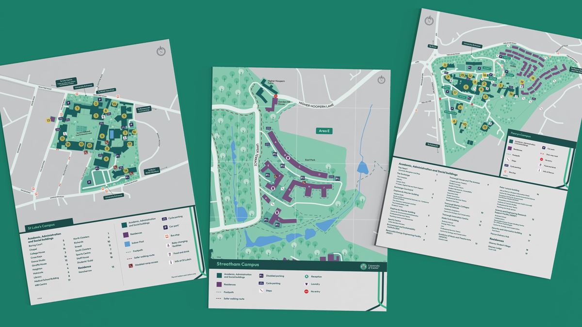
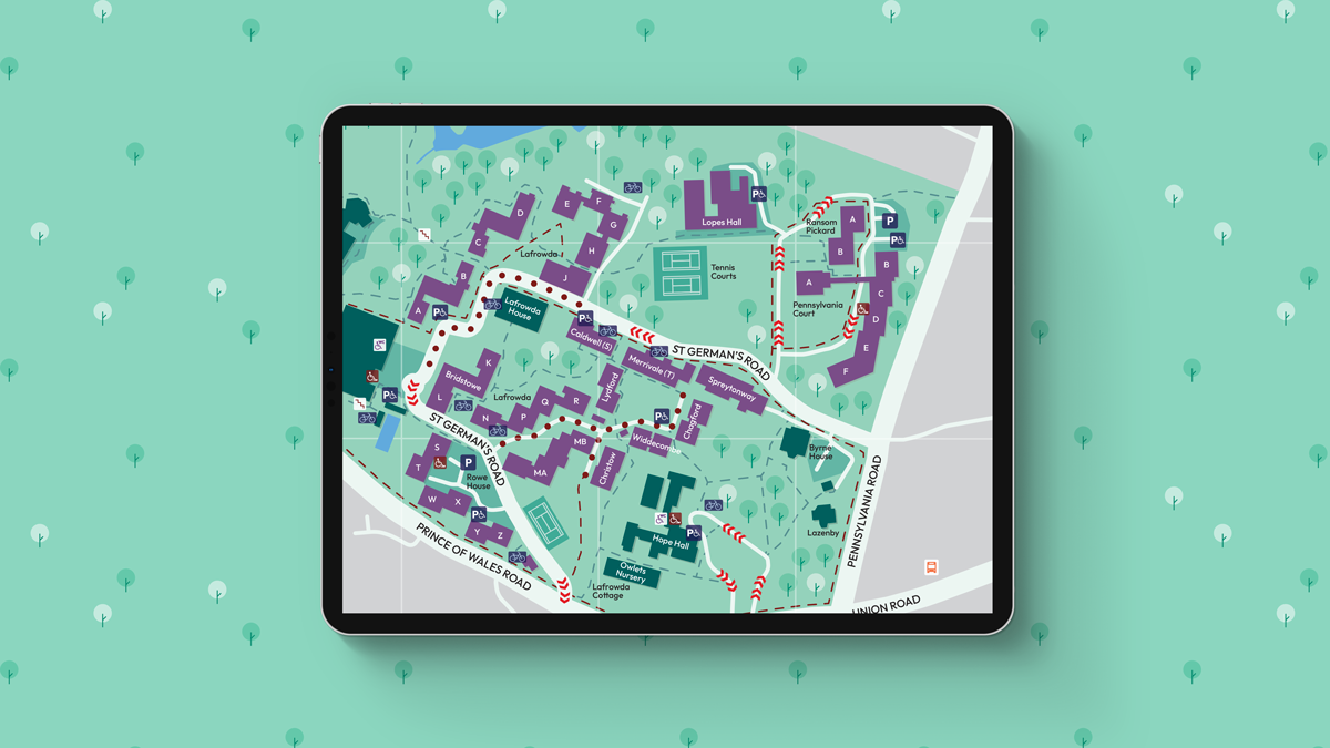
Project overview
We converted the University of Exeter’s existing print based maps into bespoke interactive online maps.
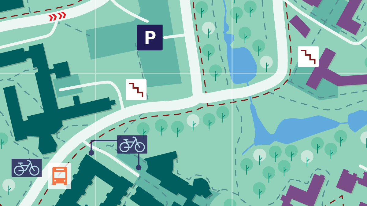
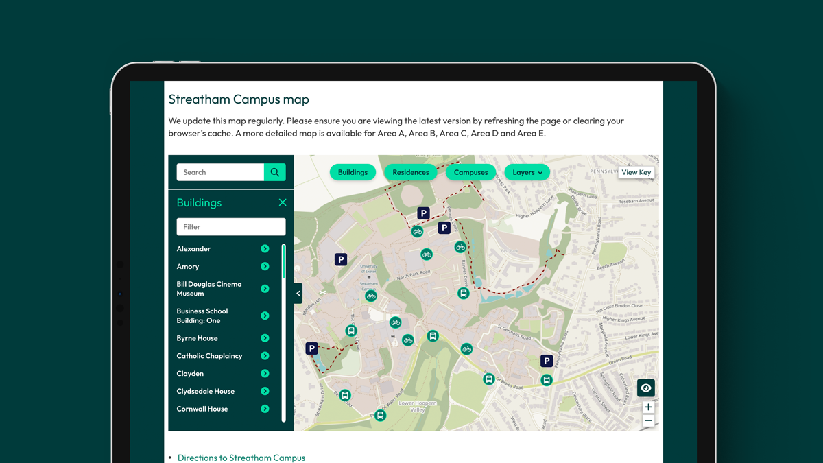
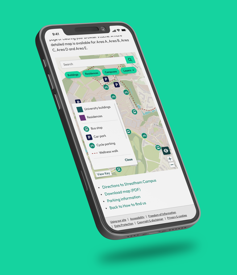
We redesigned the experience for fast scanning on mobile and desktop, with clear labels and intuitive navigation. We created bespoke illustrations to improve legibility and to give the maps a consistent, on-brand look. We integrated OpenStreetMap to support accurate location data and familiar controls.
Alongside the digital build, we supplied vector-based illustrations so the university could reuse the same assets across signage, print, and future updates.
Results
The University of Exeter now has a single set of maps that works online and in print. The interactive version is easier to use than static PDFs and supports quick wayfinding on any device.
OpenStreetMap integration keeps navigation familiar and location data reliable. Our bespoke illustrations improve clarity, reduce visual noise, and give the maps a consistent look across campuses.
Because we supplied vector artwork, the university can scale and reuse the assets across signage, brochures, and future digital updates without loss of quality. The result is a flexible map system designed to stay useful as the estate evolves.